If you’d like a print of the artwork displayed above, you can purchase one from the ArtUK online shop.
Map showing the progress of the Tunnel
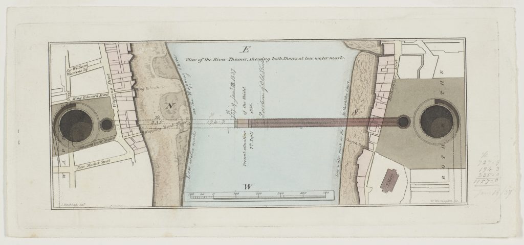
Map showing progress of the Thames Tunnel. Brunel Museum, London, LDBRU:2017.27
| Object no. | LDBRU:2017.27 |
|---|---|
| Size | 280mm (w) x 128mm (h) |
| Date | |
| Acquired | Purchased at Bonhams, 2017, with grants from NHMF, Art Fund, V&A, Friends National Libraries & Trinity Buoy Wharf |
| Condition | |
| Location | Stored offsite at TLA |